Cycle route
From Nowy Targ to Trstená on tracks that are no longer there
About 35 km of tarmac on the embankment of an old railway line, no cars, the Tatras on your left and the Slovak border in the middle of the trip. The easiest section of the Route around the Tatras. Stacja Czarny Dunajec stands halfway along the Polish part, at kilometre 11.
-
 About 35 km
20.6 km in Poland to the border and about 14.5 km in Slovakia to Trstená.
About 35 km
20.6 km in Poland to the border and about 14.5 km in Slovakia to Trstená.
-
 All tarmac
A 3 m wide path separated from road traffic. Wooden deck on the bridge at Podczerwone.
All tarmac
A 3 m wide path separated from road traffic. Wooden deck on the bridge at Podczerwone.
-
 About 200 m of climbing
From 585 m in Nowy Targ to 790 m on the border ridge. A railway embankment, so no steep climbs.
About 200 m of climbing
From 585 m in Nowy Targ to 790 m on the border ridge. A railway embankment, so no steep climbs.
-
 About 3 hours
One way, at an easy pace with stops. Family friendly, trailer included.
About 3 hours
One way, at an easy pace with stops. Family friendly, trailer included.
The route
Stop by stop
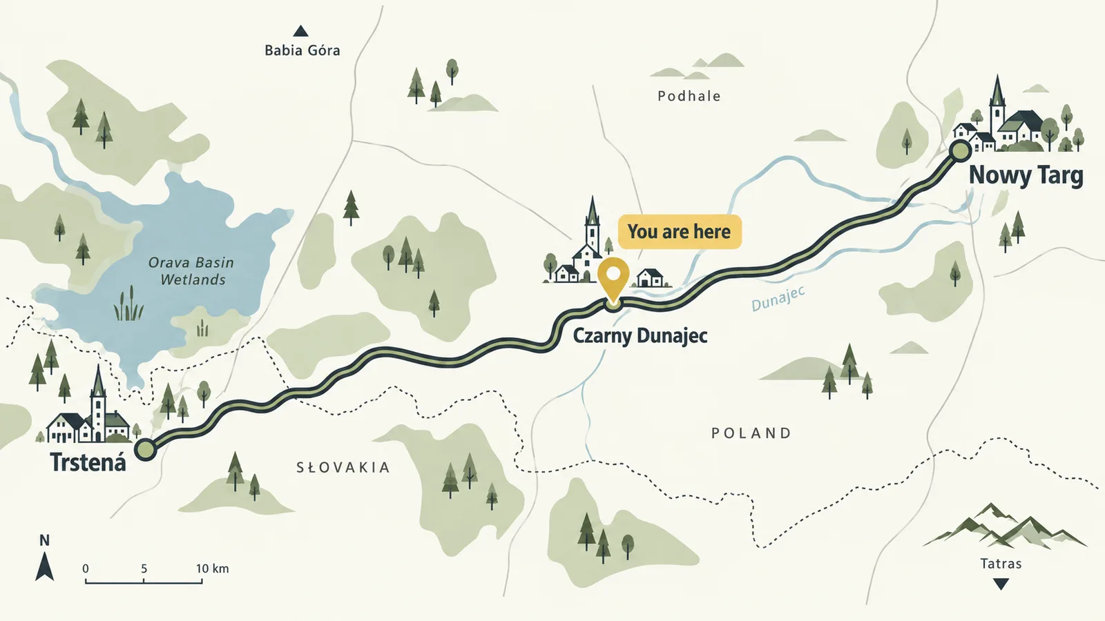
The path sticks to the old trackbed, so you ride exactly where trains ran from 1904. Kilometres are counted from Nowy Targ.
0 km
Nowy TargStart at the railway station on Kolejowa street. The town cycle path runs from Mickiewicz Park along the Czarny Dunajec river to the Bór Kombinacki forest, where the main route on the embankment begins. The historic water tower by the station still works.
3 km
LudźmierzAn iron arched truss bridge over the Wielki Rogoźnik stream and the first rest area. The old halt never had a building. A 2.5 km link road leads to the sanctuary in Ludźmierz.
6 km
RogoźnikOnce a station with a siding to a brickworks and lime kiln, the building was demolished in 2003. Next to it the Rogoźnicka Skała nature reserve, a piece of the Pieniny Klippen Belt. Between Rogoźnik and Czarny Dunajec you cross the main European watershed: water on one side flows to the Baltic, on the other to the Black Sea.
11 km
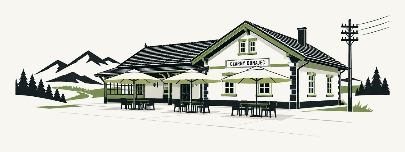
Czarny Dunajec, StacjaYou are here. A brick station from 1904, three tracks and two platforms, flats after the war, today a restaurant with a terrace right on the path. The kitchen runs daily 9:00 to 21:00, with spanners and a pump on site, bike racks and a playground. Parking at the restaurant and a park and ride by the school complex on Jana Pawła II street.
This is also the start of the 8 km Czarny Dunajec peat bog loop and the Baligówka bog nature trail.
16 km
Bridge over the Czarny DunajecAn iron riveted railway bridge 40 m long. On 1 September 1939 it collapsed into the river after an explosion. Today it is rebuilt with a wooden deck. A picnic spot, weirs on the river and the best photo stop on the whole section.
17 km
PodczerwoneThe second restored station on the line. After the war it was the terminus for forty years, because the tracks beyond it led only to the border. Today a bistro, a bike rental and an outdoor exhibition on the history of the line in Polish, Slovak and English. Link roads lead from here to Chochołów and Koniówka.
20.6 km
The borderThe last kilometres before the border are the longest climb of the route: the track rose at 25 per mille for about 5 km, still an easy pace on a bike. The path cuts across the Orava and Nowy Targ peat bogs and crosses the border on a wooden bridge over the Jelešňa stream, exactly where the train once ran. The highest point of the route, about 790 m above sea level.
21 km
Suchá HoraThree hundred metres past the border stands the ruin of the biggest station on the section. For thirty years it housed the railway customs office between Poland and Czechoslovakia. Do not go inside, look from the embankment. The village itself is 2 km away.
24 km
HladovkaA village that never had a station but has two shelters by the path and a view of the Western Tatras from the Slovak side. From the border it is downhill all the way.
30 km
LiesekAn old station in good condition, now a weather station. By the path a chapel with a spring, the only place on the route where you can fill your bottles. A shelter and a shop in the village.
35 km
TrstenáThe path ends at a working railway station with trains to Kraľovany. A town square with cafés, halušky and Kofola at the finish. Free parking by the station if you prefer to start on the Slovak side and ride into Poland.
Practical
Before you set off
By train or by car
Trains from Kraków to Nowy Targ carry bikes. By car the easiest option is Stacja: parking on site and a second park and ride by the school complex. Slovak regional trains reach Trstená.
ID and euros
There have been no checks since 2007, but carry your ID card or passport. On the Slovak side you pay in euros, by card almost everywhere.
Bring bottles
The only spring on the route is by the chapel above Liesek. Food: Nowy Targ, Stacja Czarny Dunajec, Podczerwone, Trstená. Rest areas with shelters about every 3 km.
Spanners, pump, bikes
At Stacja you can fix the small things at the table. Bike rentals operate in Nowy Targ and Podczerwone, ours opens soon. The nearest bike shops are in Nowy Targ.
Impossible to get lost
On the Polish side signs with the Route around the Tatras logo, on the Slovak side kilometre posts and the red Orava cycle trail no. 006. Map and GPX at szlakwokoltatr.eu.
Spring to autumn
Best from May to October. In winter the path is not cleared and serves cross-country skiers. Stacja is open all year, also for those arriving by car.
Along the way
Worth seeing
Peat bogs
The Orava and Nowy Targ peat bogs are over 8 thousand hectares of Natura 2000 between Koniówka and the border. The Baligówka nature trail has 13 boards and a shepherd hut with oscypek cheese and sheep whey. The Bór za Lasem peat works keeps a museum narrow gauge railway.
Reserves and views
Bór na Czerwonem with a lookout tower, Bór Kombinacki, Rogoźnicka Skała. From the embankment you see the Tatras, the Gubałówka foothills, the Orava hills, Babia Góra and the Gorce.
Railway traces
Bridges at Ludźmierz and Podczerwone, embankments up to 10 m high, kilometre posts on the Slovak side, old stations in Czarny Dunajec, Podczerwone, Suchá Hora and Liesek. The full story of the line is on a separate page.
Questions
What people ask
Stop at the Station
Kilometre eleven from Nowy Targ, nine to the border. A hot lunch, a cold lemonade and a table with a view of the trail. Drop in before you ride on.
Distances, climbs and times are approximate and come from route maps and riders' reports. Check the state of buildings and food stops along the way before you set off, especially on the Slovak side.